Ramsey County, Minnesota

Ramsey County, Minnesota
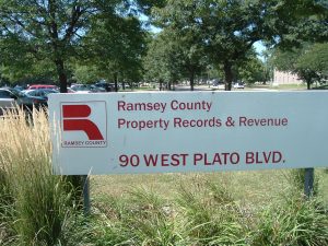
Ramsey County, Minnesota, established in 1849, is located in the eastern part of the Twin Cities seven-county Metro area – the sixteenth largest metropolitan area in the United States.
The county seat in Ramsey County, Minnesota is located in the city of St. Paul, which is Ramsey County’s largest city by population.
The Mississippi River flows through the city of St. Paul.
U.S. Interstate Highways 94, and 694, are the primary east-west transportation routes in Ramsey County, Minnesota.
U.S. Interstate Highways 35E and 35W are the primary north-south transportation routes for Ramsey County, Minnesota.
Ramsey County, Minnesotais bordered:
- on the north by Anoka County,
- on the west by Hennepin County,
- on the south by Dakota County, and
- on the east by Washington County.
In the spring of 1849, a bill was passed by the U.S. Congress which created the Minnesota Territory.
Later that year, nine Minnesota counties were formed, including Ramsey County, Minnesota, which at that time included:
- all of the present-day counties of Anoka, Isanti, Kanabec, and Ramsey, and
- parts of Aitkin, Carlton, Hennepin, Mille Lacs, Pine, and Washington counties.
After the Civil War, construction of the railroads in Minnesota made St. Paul, and thus Ramsey County, Minnesota, the transportation center of the upper Midwest, and the gateway to the Pacific Northwest.
Towards the end of the 19th century, the Great Northern Railroad linked Minnesota with both Chicago, and the Pacific Ocean.
In 1888, eight million people passed through St. Paul’s Union Depot, on 150 daily train arrivals and departures.
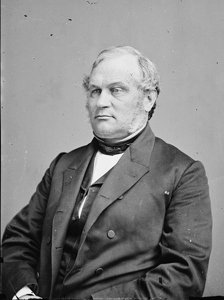
 Ramsey County, Minnesota is named for Alexander Ramsey:
- the mayor of St. Paul in 1855;
- the first governor of the Minnesota Territory, serving from 1849 – 1853;
- the second governor of the State of Minnesota, serving from 1860 – 1863;
- the fourth U.S. Senator from Minnesota, serving from 1863 – 1875; and
- the U.S. Secretary of War from 1879 – 1881, serving under President James A. Garfield.
Ramsey County, Minnesota Courthouse
The Ramsey County Courthouse, a classic skyscraper built in 1930 – which is listed on the National Register of Historic Places, and located at 15 Kellogg Boulevard West in downtown St. Paul – has an interior Art Deco design that is a must see for anyone visiting St. Paul.
Ramsey County, Minnesota Population
Ramsey County, Minnesota had a population of 508,640, as of the 2010 Census, a decrease of 0.5% from the 2000 Census population of 511,035.
Ramsey County is the smallest Minnesota County geographically, and its most dense in terms of population.
Notwithstanding its urban orientation, Ramsey County is surprisingly diverse in regards to land-use, encompassing urban areas, first and second ring suburbs, small towns, and large suburban developments.
Ramsey County, Minnesota Primary Cities
The city of St. Paul is the county seat for Ramsey County, Minnesota, and had a population of 285,068 as of the 2010 Census.
Other notable cities in Ramsey County, Minnesota include Falcon Heights, Gem Lake, Lauderdale, Little Canada, Maplewood, Mounds View, New Brighton, North St. Paul, Roseville, Shoreview, Vadnais Heights, White Bear Lake, and parts of Blaine, St. Anthony, and Spring Lake Park.
Arden Hills
The city of Arden Hills, incorporated in 1951, is located in northern Ramsey County.
As of the 2010 Census, the population of Arden Hills was 9,552:
- 16.1% of the population of Arden Hills was under the age of 18,
- 26.1% of the population of Arden Hills was age 18 to 24,
- 16.1% of the population of Arden Hills was age 25 to 44,
- 26.2% of the population of Arden Hills was age 45 to 64, and
- 15.6% of the population of Arden Hills was age 65 years or older.
The median income for a household in Arden Hills was $64,773, and the median income for a family was $72,236.
Arden Hills is bordered by the cities of:
- Shoreview to the east and north,
- Roseville to the south,and
- Mounds View and New Brighton to the west.
The former Twin Cities Army Ammunition Plant (the “Arsenal”), lies in the northern portion of Arden Hills, and Lake Johanna and Lake Josephine are the pride of the city.
Mounds View Independent School District 621
High Schools:
- Irondale High School, Grades 9-12 (go Knights!);and
- Mounds View High School, Grades 9-12 (go Mustangs!).
Middle Schools:
- Chippewa, Grades 6-8;
- Edgewood, Grades 6-8; and
- Highview, Grades 6-8.
Elementary schools:
Valentine Hills – one of six elementary schools in Independent School District 621.
Institutions of higher education within the city of Arden Hills include Bethel University and Seminary, and the northern part of Northwestern University – St. Paul.
Blaine
The city of Blaine is located primarily in southeastern Anoka County, with a very small section located in northwestern Ramsey County, Minnesota.
Blaine is bordered by the cities of:
- Ham Lake to the north,
- Coon Rapids to the west,
- Spring Lake Park, Mounds View and Shoreview to the south, and
- Circle Pines, Lexington, and Lino Lakes to the east.
As of the 2010 Census, the population of Blaine was 57,186:
- 26.5% of the population of Blaine was under the age of 18,
- 7.4% of the population of Blaine was age 18 to 24,
- 30.7% of the population of Blaine was age 25 to 44,
- 27.0% of the population of Blaine was age 45 to 64,
- 8.5% of the population of Blaine was over the age of 65 years.
The median income for a household in the city of Blaine was $59,219, and the median income for a family was $63,831.
In 1877, Blaine separated from the city of Anoka and was organized as a township – named after James G. Blaine – a senator and three-time presidential candidate from Maine.
The city of Blaine is home to the 600-acre National Sports Center, which features:
- 50 plus soccer fields – including a stadium,
- a golf course and driving range,
- a velodrome,and
- the Schwan’s Super Rink – containing 4 Olympic sized, and 4 regulation sized, ice rinks.
The city of Blaine is served by the Anoka-Hennepin, Centennial, and Spring Lake Park School Districts.
Higher education opportunities within the city of Blaine are offered by the Globe University/Minnesota School of Business – a private career college and trade school.
Mounds View
The city of Mounds View is located in northern Ramsey County, and is bordered by the cities of:
- Blaine to the north,
- New Brighton to the south,
- Shoreview to the east, and
- Spring Lake Park and Fridley to the west.
As of the 2010 Census, the population of the city of Mounds View was 12,155:
- 23.1% of the population of Mounds View was under the age 18,
- 8.8% of the population of Mounds View was age 18 to 24,
- 27.9% of the population of Mounds View was age 25 to 44,
- 27.6% of the population of Mounds View was age 45 to 64, and
- 12.6% of the population of Mounds View was 65 years of age or older.
The median income for a household in Mounds View was $51,974, and the median income for a family was $60,685.
The city of Mounds View was created out of Mounds View Township, which included parts of present-day Shoreview, Arden Hills, and Spring Lake Park.
In 1958, the village of Mounds View was incorporated.
While the city is primarily residential, local businesses include Medtronic, Multitech, Liberty Checks, Sysco Distributing and the Mermaid Entertainment Center.
New Brighton
The city of New Brighton is located in northern Ramsey County, and is bordered by the cities of:
- Mounds View to the north,
- St. Anthony and Roseville to the south,
- Arden Hills to the east, and
- Columbia Heights and Fridley to the west.
As of the 2010 Census, there were 21,456 people residing in the city:
- 21.1% of the population of New Brighton was under the age of 18,
- 9.4% of the population of New Brighton was age 18 to 24,
- 24.5% of the population of New Brighton was age 25 to 44,
- 27.2% of the population of New Brighton was age 45 to 64, and
- 17.7% of the population of New Brighton was 65 years of age or older.
The median income for a household in New Brighton was $52,856, and the median income for a family was $68,724.
In the 1700s, Dakota Indian tribes lived in the New Brighton area, harvesting wild rice by Long Lake.
After the railroads moved into the New Brighton area, wealthy investors from Minneapolis formed the Minneapolis Stockyards and Packing Company in 1888, and the City of New Brighton was incorporated on January 20, 1891.
In recent years, New Brighton has celebrated “Stockyard Days” every summer at Long Lake Regional Park – the former site of many of the stockyards.
New Brighton has several beautiful lakes – including Long Lake, Pike Lake, and Stony Lake – one seminary, and many churches and places of worship.
Four public schools are located in New Brighton:
- Bel Air Elementary School,
- Sunnyside Elementary,
- Highview Middle School, and
- Irondale High School,
all of which are part of the Mounds View Public Schools (District 621).
See also: New Brighton – Brightwood Hills Golf Course Historical Photos
North Oaks
North Oaks is located 10 miles north of the city of St. Paul, in Ramsey County Minnesota.
All of the occupied land in North Oaks is owned by its homeowners, and all of the roads, snowplowing, park facilities, and trails are maintained by the North Oaks Home Owner’s Association.
However, North Oaks has a governing body, with a Mayor and a City Council, that supervises administration of such services as fire and police protection, planning and zoning, and city licensing.
Since the city of North Oaks owns no real property, Twin Cities metropolitan governing councils do not have any jurisdiction over the city’s comprehensive plan.
A big attraction in North Oaks is Pleasant Lake, which formerly provided municipal water for the Saint Paul water system, which still has certain water access rights.
The land that was to become the Farm at North Oaks was purchased in 1883 by railroad baron James J. Hill, who used it as a hobby farm.

Upon his death, the Farm at North Oaks was owned by his son, Louis Hill, until his death in 1950.
Thereafter, ownership of the Farm at North Oaks descended to the children of Louis Hill, who voted to develop the land into a residential community, resulting in the incorporation of the North Oaks Company.
As of the 2010 Census, there were 4,469 people residing in the city of North Oaks:
- 27.6% of the population of North Oaks was under the age of 18,
- 4.7% of the population of North Oaks was age 18 to 24,
- 17.6% of the population of North Oaks was age 25 to 44,
- 38.5% of the population of North Oaks was age 45 to 64, and
- 11.6% of the population of North Oaks was 65 years of age or older.
The median income for a household in the city was $149,158, and the median income for a family was $152,380.
Spring Lake Park
The city of Spring Lake Park is located primarily in Anoka County, but a small section of Spring Lake Park is located in Ramsey County.
Spring Lake Park is bordered by the cities of:
- Blaine to the north,
- Fridley to the east and South, and
- Mounds View to the west.
As of the 2010 Census, there were 6,412 people residing in Spring Lake Park:
- 19.9% of the population of Spring Lake Park was under the age of 18,
- 8.7% of the population of Spring Lake Park was age 18 to 24,
- 6.6% of the population of Spring Lake Park was age 25 to 44,
- 28.5% of the population of Spring Lake Park was age 45 to 64, and
- 16.5% of the population of Spring Lake Park was age 65 years of age or older.
The median income for a household in Spring Lake Park was $46,646, and the median income for a family was $56,922.
The city of Spring Lake Park is served by the Spring Lake Park School District (Go Panthers!).
Shoreview
The city of Shoreview – incorporated in 1957 – is located in northern Ramsey County, and is bordered by the cities of:
- Mounds View and Arden Hills to the west,
- Roseville to the south,
- Vadnais Heights, Little Canada, and North Oaks to the east,and
- Blaine, Circle Pines and Lino Lakes to the north.
As of the 2010 Census, the population of Shoreview was 25,924:
- 21.6% of the population of Shoreview was under the age of 18,
- 7.2% of the population of Shoreview was age 18 to 24,
- 21.8% of the population of Shoreview was age 25 to 44,
- 35.1% of the population of Shoreview was age 45 to 64, and
- 14.4% of the population of Shoreview was 65 years of age or older.
According to a 2009 survey, the median income for a household in Shoreview was $78,980, and the median income for a family was $97,725.
According to a survey of Shoreview’s population over age 25 (16,933 respondents):
- 80.4% had completed high school or higher:
- 24.4% had completed a Bachelor’s degree or higher:
- 17.9% had completed a graduate or professional degree.
The city of Shoreview has many fine lakes, including Turtle Lake, Snail Lake, Lake Owasso, and Island Lake.
The Shoreview Community Center features fitness activities, private event rentals, and swimming facilities.
The majority of FM and television broadcasters in the Twin Cities-area have had their transmitters and antennae based in Shoreview since the early 1970s.
In February of 1850, the first European-American person settled on land in the region that is now within the boundaries of the City of Shoreview.
Shortly thereafter, more European settlers arrived from Switzerland, England, Ireland, and Germany, and American settlers from Vermont, Virginia, Illinois and New York.
In the beginning, Shoreview was a part of Mounds View Township, which was organized on May 11, 1858 – by coincidence on the same day that Minnesota became a state.
In the late 19th century, the Soo Line Railroad came to the region now known as Shoreview.
On March 14, 1957 certain Ramsey County citizens petitioned the Ramsey County Board of Commissioners for the incorporation of the Village of Shoreview – which was designed to separate Shoreview from Mounds View Township.
The incorporation of the Village of Shoreview was approved by a vote of 853 to 748, in a hotly contested election.
Thereafter, on April 23, 1957, Shoreview was officially incorporated, at a time when Shoreview had a population of 5,231.
On December 10, 1963, Interstate Highway 694 – then known as “Highway 100” – was opened through Shoreview.
On January 1, 1974 – when its population was just over 14,000 – Shoreview elected to become a city .
Copyright 2018 – All Rights Reserved
Gary C. Dahle – Attorney at Law
2704 County Road 10
Mounds View, MN 55112
Phone: 763-780-8390 Fax: 763-780-1735 gary@dahlelaw.com
Links:
Western North Dakota Counties – see http://www.dahlelawnorthdakota.com/north-dakota-counties/
